Saturday, August 27, 2005
08/23/05 Tuesday and 08/24/05 Wednesday - Seward to Palmer
08/23/05 Tuesday-08/24/05- Wednesday

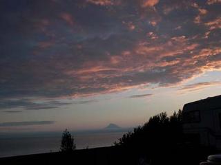
It rained all night, off and on. We got up and got hooked up to travel in the rain. We traveled from Seward to Palmer. Our travel buddies were Art and Teri White. They are the only other full timers on the caravan. They are from Minnesota but have an address in Livingston Texas for their mail delivery. We left at 8:20 and got here about 12:30 and drove in the rain most of the way.
We drove roads that we had already been over all the way from Seward to Anchorage. We passed within a few blocks of the campground where we stayed in Anchorage. We had rain and a lot of high wind in the Anchorage area. Palmer, where we are now, is probably about 40 miles from Anchorage.
It cleared off about mid-afternoon and we were able to get out. Our next-door neighbor is from Albuquerque, NM. Rossana came over and invited us to eat dinner with them. They had another couple there that was also from NM. We had a nice visit with them. While we were eating Doris Cundiff came by and invited us to their house for desert. She and Marv celebrated their 49th wedding anniversary.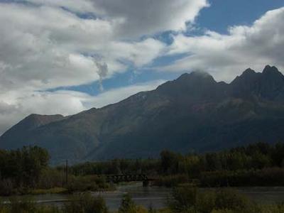 They bought a big cake and had everyone down for cake and coffee; we were pleased to get to share their day. There are a lot of couples on the caravan who have been married longer than 40 years.
Its Wednesday 08/24/05, and a beautiful day. I watched the sun come up over the mountain, sitting by a campfire eating biscuits and gravy. Our Holiday Rambler staff cooked breakfast for us this morning.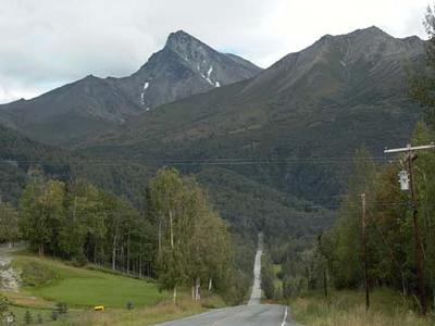 We were up late last night so Mary slept in, but I went to breakfast. We had a nice pavilion with a fire pit and the campground even provided the wood. We are having a turkey fry and salad bar dinner tonight, also provided by the staff.
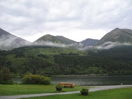
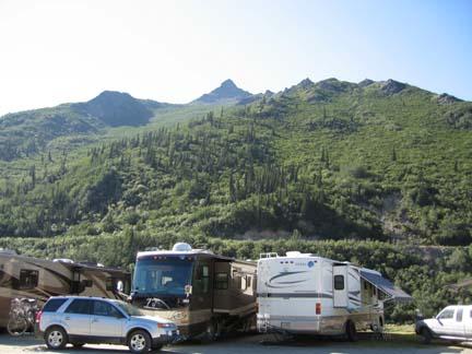
I’m summarizing the day while it is still early. We are not doing anything today so I am trying to get my Journal caught up and posted to the blog. Mary says if there is bright sunlight later in the day she might go out and get some pictures of the mountains surround the park. The name of the park is Mountain View RV Park, and it really is.
It rained all night, off and on. We got up and got hooked up to travel in the rain. We traveled from Seward to Palmer. Our travel buddies were Art and Teri White. They are the only other full timers on the caravan. They are from Minnesota but have an address in Livingston Texas for their mail delivery. We left at 8:20 and got here about 12:30 and drove in the rain most of the way.
We drove roads that we had already been over all the way from Seward to Anchorage. We passed within a few blocks of the campground where we stayed in Anchorage. We had rain and a lot of high wind in the Anchorage area. Palmer, where we are now, is probably about 40 miles from Anchorage.
It cleared off about mid-afternoon and we were able to get out. Our next-door neighbor is from Albuquerque, NM. Rossana came over and invited us to eat dinner with them. They had another couple there that was also from NM. We had a nice visit with them. While we were eating Doris Cundiff came by and invited us to their house for desert. She and Marv celebrated their 49th wedding anniversary.
 They bought a big cake and had everyone down for cake and coffee; we were pleased to get to share their day. There are a lot of couples on the caravan who have been married longer than 40 years.
Its Wednesday 08/24/05, and a beautiful day. I watched the sun come up over the mountain, sitting by a campfire eating biscuits and gravy. Our Holiday Rambler staff cooked breakfast for us this morning.
 We were up late last night so Mary slept in, but I went to breakfast. We had a nice pavilion with a fire pit and the campground even provided the wood. We are having a turkey fry and salad bar dinner tonight, also provided by the staff.
I’m summarizing the day while it is still early. We are not doing anything today so I am trying to get my Journal caught up and posted to the blog. Mary says if there is bright sunlight later in the day she might go out and get some pictures of the mountains surround the park. The name of the park is Mountain View RV Park, and it really is.
08/21/05 Sunday and 08/22/05 Monday - Homer to Seward
. 08/21/05, Sunday and 08/22/05 Monday
It’s 168 miles from Homer to Seward. We had a short drove, but there was a fishing tournament going on and we could not get into our campground until 4:00 PM.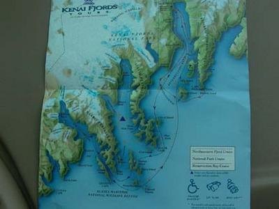 We left at 10:40 and traveled with Gail and Johnny DuBose. They are some of our favorite people on the caravan. They live in New Port Richey, Florida.
The travel through the Kenai Peninsula is very beautiful and easier than many of the highways that we traveled in the interior. There are big mountains and a lot of glaciers, but the mountains are spread acorss large areas and have flat land in between. There are three volcanoes that are visible from the highway between Homer and Ninilchik. We stopped a couple of times on the stretch Mary and Gail got some really good pictures. They walked about a quarter of a mile across a field and ended up standing on a bluff looking down several hundred feet at the water and shot the mountains across the water. I don’t remember the name of the little river, but we stopped at a rest area and I went to the restroom. Mary, Gail and Johnny walked down to the river and got pictures of the stream and even some of the fishermen who were down there fishing for salmon.
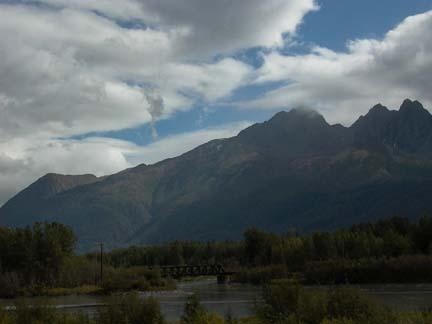
We stopped just after we went through Soldotna and had lunch at a place named Susie’s. It was small and crowded with Sunday travelers so we had a pretty long wait. The lunch was great and worth the wait. We finished our trip and arrived at our campground about 4:15 PM. We stayed in a city park that was spread along the shore of Resurrection Bay. We pulled into our space on the second row looking directly across the bay at a mountain range with two large glaciers visible to us. Mary looked at the view and got her camera. She said that she was going to take a picture and when anyone asked why we wanted to be full timers she would just show them the picture.
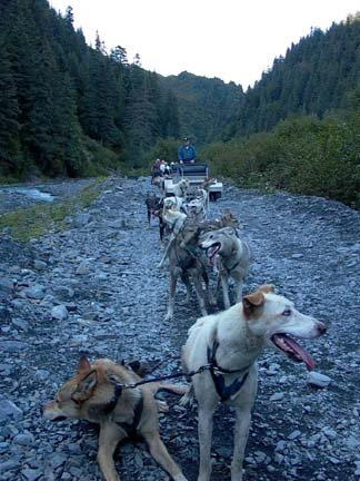
After we were set up and got ready we car convoyed out of town to see another sled dog demonstration. We had already seen three of these and I was not too excited about another one. We went to a place called IdidaRide Sled Dog Tours It is owned by Mitch Seavey, the 2004 Iditarod Champion. His Father is one of the founders of the race and ran in the first race. Mitch has three sons and the oldest has already run in the race. I believe that they told us that the Seavey family is the only three-generation participants in the Iditarod. We got to see all the dogs, see how they were trained, what they ate and where they lived. We saw the puppies, and they all got passed around so we held and played with them. The kennel felt that this helped the puppies grow up trusting humans and responding to them in a favorable way. Later we saw why that was important. The second thing we got was a look at what the musher wore and the equipment that he took with him on the trail. They truly test the elements and their endurance as well as the training and conditioning of the dogs.
The last thing we did was to ride in a large sled with seats for six people. They hooked thirteen dogs to the sled and we got a two-mile ride. The sled had wide rubber tires instead of runners, and weighed about 500 pounds. It was amazing to see the dogs work as a team and respond to the commands that the musher gave to them. The only control that he has over the team is verbal. It is impressive. They had four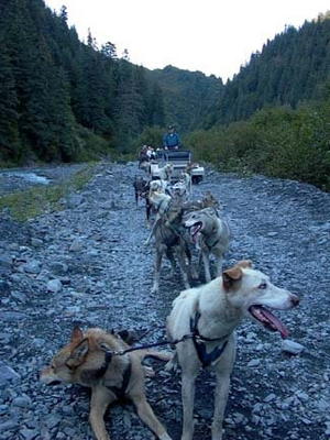 drivers there for our group. Mary got all their names so we can keep up with their progress as sled dog racers. and she got two of them to autograph the back of a picture which we bought of our group riding the sled. She told this young kid that now she world already have his autograph when he won the Iditarod.
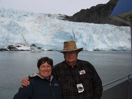
It was getting late when we finished at the kennel, but it was time well spent. We had to rush, but we wanted to go up to Kenai Fjords National Park. It was only about six miles away and there was a glacier there named Exit Glacier. We walked about nine tenths of a mile up to the edge of the glacier. We actually touched the ice and had our picture made standing directly in front of that wall of ice that is about 3500 years old. I don’t know how high the face of the glacier is, but from looking at people standing in front of it I would estimate about 50-60 feet. As we walked up we passed signs with years on them making the point the glacier had been in that year.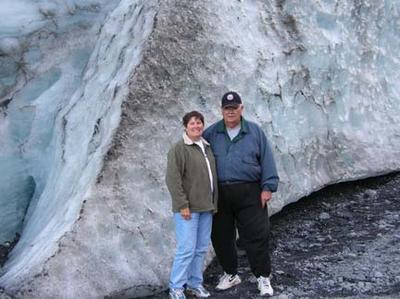 The oldest sign was for 1951 and I guess the ice and retreated about a half a mile in that fifty-four years. At one time the entire valley was filled with ice. Global warming is not such a new topic.
We stopped at Safeway on the way home to pick up a few groceries. We looked at the note board on the Wagon Masters Motor home and saw that we have to catch the bus at 7:15 AM for a tour of the Kenai Fjords. It is ten o’clock when we got home. Short night. Sleep fast!!
On Monday 08/22/05 we caught the bus and went to the dock where we boarded a boat for a tour of the Kenai Fjords. The fjords are waterways that were formed by the glaciers. As the ice receded it left valleys and mountains. It also left streams, coves and bays that are part of the ocean. We traveled around the shoreline of the extreme North Pacific Ocean. The guy who drove the boat was our narrator and he knew a great deal about the area, the mountains, the glaciers, and the marine life we saw a lot of all of that. We wer e on the boat from about 7:30 until 2:30. The served lunch so we didn’t even have to stop for that. The entire area in which we traveled was a National Park. We must have gone 70 or 80 miles. We saw a boat in the port marked National Park Service. We were told that Kenai Fjords Park had more boats than it had pickup trucks.
Most of the pictures we took do not show the birds or animals as well as we would like to have them shown. They will be enough to be a reminder for us of a great day we spent in a really wild, isolated area. We saw a lot of animals, fish and birds. First we saw a Bald Eagle, we saw three different kinds of sea gulls, and ravens. Two of my favorites were the Puffins and Ordinary Muir. Both of these birds are fish eaters and divers. The Puffins can dive down to 350 feet into the water. The Muir can go as deep as 600 feet. They don’t fly well because their bodies are heavy and big and they do not have hollow bones like most birds. The Puffins sometimes eat so much that they cannot get off the water to fly. They actually use their wings to propel themselves through the water when they dive. The Muir is like a Penguin except that he can fly. One other bird that we saw a lot of is the Cormorant. All of these birds contributed something to the survival of the Indian and Eskimo people who live in this area. They are still hunted and trapped today for their skin, feathers, bones and in some cases meat.
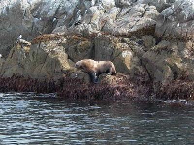
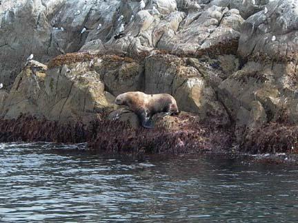
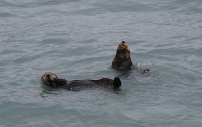 In the water we saw three Humpback Whales, schools of salmon and smaller fish, and we saw some Dall Porpoise. The porpoise played with the boat, swam under the bow and along the side. As we picked up speed they followed along and jumped in the wake. We saw Sea Lions and got close enough to hear them roar. We saw fur seals and harbor seals and saw Sea Otter and watched them play. The captain told us the otter lived 99% of its life in water. It is a mammal, gives live birth, but it seldom goes on land.
We saw a glacier named Holgate Glacier. It made the one we saw last night look tiny. We approache d to within a quarter of a mile. The face of the ice flow is from 300 to 500 feet high. There was a hole at the base where a large river gushed out into the bay. The water came from melt and from rain. The captain shut down the engines and generators and we sat for about twenty minutes in silence listening to the ice creak and groan. Occasionally a chunk of ice would break off and fall into the water. This is called calving. The water was dotted with big ice chunks for several hundred yards.
We returned to port about 2:30. It was a very nice day and we enjoyed seeing the wildlife. As we ere coming in it got cloudier and the wind blew harder. By night it was raining
It’s 168 miles from Homer to Seward. We had a short drove, but there was a fishing tournament going on and we could not get into our campground until 4:00 PM.
 We left at 10:40 and traveled with Gail and Johnny DuBose. They are some of our favorite people on the caravan. They live in New Port Richey, Florida.
The travel through the Kenai Peninsula is very beautiful and easier than many of the highways that we traveled in the interior. There are big mountains and a lot of glaciers, but the mountains are spread acorss large areas and have flat land in between. There are three volcanoes that are visible from the highway between Homer and Ninilchik. We stopped a couple of times on the stretch Mary and Gail got some really good pictures. They walked about a quarter of a mile across a field and ended up standing on a bluff looking down several hundred feet at the water and shot the mountains across the water. I don’t remember the name of the little river, but we stopped at a rest area and I went to the restroom. Mary, Gail and Johnny walked down to the river and got pictures of the stream and even some of the fishermen who were down there fishing for salmon.
We stopped just after we went through Soldotna and had lunch at a place named Susie’s. It was small and crowded with Sunday travelers so we had a pretty long wait. The lunch was great and worth the wait. We finished our trip and arrived at our campground about 4:15 PM. We stayed in a city park that was spread along the shore of Resurrection Bay. We pulled into our space on the second row looking directly across the bay at a mountain range with two large glaciers visible to us. Mary looked at the view and got her camera. She said that she was going to take a picture and when anyone asked why we wanted to be full timers she would just show them the picture.
After we were set up and got ready we car convoyed out of town to see another sled dog demonstration. We had already seen three of these and I was not too excited about another one. We went to a place called IdidaRide Sled Dog Tours It is owned by Mitch Seavey, the 2004 Iditarod Champion. His Father is one of the founders of the race and ran in the first race. Mitch has three sons and the oldest has already run in the race. I believe that they told us that the Seavey family is the only three-generation participants in the Iditarod. We got to see all the dogs, see how they were trained, what they ate and where they lived. We saw the puppies, and they all got passed around so we held and played with them. The kennel felt that this helped the puppies grow up trusting humans and responding to them in a favorable way. Later we saw why that was important. The second thing we got was a look at what the musher wore and the equipment that he took with him on the trail. They truly test the elements and their endurance as well as the training and conditioning of the dogs.

The last thing we did was to ride in a large sled with seats for six people. They hooked thirteen dogs to the sled and we got a two-mile ride. The sled had wide rubber tires instead of runners, and weighed about 500 pounds. It was amazing to see the dogs work as a team and respond to the commands that the musher gave to them. The only control that he has over the team is verbal. It is impressive. They had four
 drivers there for our group. Mary got all their names so we can keep up with their progress as sled dog racers. and she got two of them to autograph the back of a picture which we bought of our group riding the sled. She told this young kid that now she world already have his autograph when he won the Iditarod.
It was getting late when we finished at the kennel, but it was time well spent. We had to rush, but we wanted to go up to Kenai Fjords National Park. It was only about six miles away and there was a glacier there named Exit Glacier. We walked about nine tenths of a mile up to the edge of the glacier. We actually touched the ice and had our picture made standing directly in front of that wall of ice that is about 3500 years old. I don’t know how high the face of the glacier is, but from looking at people standing in front of it I would estimate about 50-60 feet. As we walked up we passed signs with years on them making the point the glacier had been in that year.
 The oldest sign was for 1951 and I guess the ice and retreated about a half a mile in that fifty-four years. At one time the entire valley was filled with ice. Global warming is not such a new topic.
We stopped at Safeway on the way home to pick up a few groceries. We looked at the note board on the Wagon Masters Motor home and saw that we have to catch the bus at 7:15 AM for a tour of the Kenai Fjords. It is ten o’clock when we got home. Short night. Sleep fast!!
On Monday 08/22/05 we caught the bus and went to the dock where we boarded a boat for a tour of the Kenai Fjords. The fjords are waterways that were formed by the glaciers. As the ice receded it left valleys and mountains. It also left streams, coves and bays that are part of the ocean. We traveled around the shoreline of the extreme North Pacific Ocean. The guy who drove the boat was our narrator and he knew a great deal about the area, the mountains, the glaciers, and the marine life we saw a lot of all of that. We wer
 e on the boat from about 7:30 until 2:30. The served lunch so we didn’t even have to stop for that. The entire area in which we traveled was a National Park. We must have gone 70 or 80 miles. We saw a boat in the port marked National Park Service. We were told that Kenai Fjords Park had more boats than it had pickup trucks.
Most of the pictures we took do not show the birds or animals as well as we would like to have them shown. They will be enough to be a reminder for us of a great day we spent in a really wild, isolated area. We saw a lot of animals, fish and birds. First we saw a Bald Eagle, we saw three different kinds of sea gulls, and ravens. Two of my favorites were the Puffins and Ordinary Muir. Both of these birds are fish eaters and divers. The Puffins can dive down to 350 feet into the water. The Muir can go as deep as 600 feet. They don’t fly well because their bodies are heavy and big and they do not have hollow bones like most birds. The Puffins sometimes eat so much that they cannot get off the water to fly. They actually use their wings to propel themselves through the water when they dive. The Muir is like a Penguin except that he can fly. One other bird that we saw a lot of is the Cormorant. All of these birds contributed something to the survival of the Indian and Eskimo people who live in this area. They are still hunted and trapped today for their skin, feathers, bones and in some cases meat.
 In the water we saw three Humpback Whales, schools of salmon and smaller fish, and we saw some Dall Porpoise. The porpoise played with the boat, swam under the bow and along the side. As we picked up speed they followed along and jumped in the wake. We saw Sea Lions and got close enough to hear them roar. We saw fur seals and harbor seals and saw Sea Otter and watched them play. The captain told us the otter lived 99% of its life in water. It is a mammal, gives live birth, but it seldom goes on land.
We saw a glacier named Holgate Glacier. It made the one we saw last night look tiny. We approache
 d to within a quarter of a mile. The face of the ice flow is from 300 to 500 feet high. There was a hole at the base where a large river gushed out into the bay. The water came from melt and from rain. The captain shut down the engines and generators and we sat for about twenty minutes in silence listening to the ice creak and groan. Occasionally a chunk of ice would break off and fall into the water. This is called calving. The water was dotted with big ice chunks for several hundred yards.
We returned to port about 2:30. It was a very nice day and we enjoyed seeing the wildlife. As we ere coming in it got cloudier and the wind blew harder. By night it was raining
08/17/05 Wednesday through 08/20/08 Saturday - Kenai to Homer
08/17/05 Wednesday through 08/20/05 Saturday
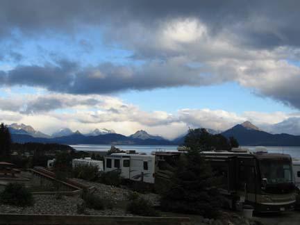
Homer might be my favorite place that we have visited so far. We only had about an 80-mile drive to get from Kenai to Homer. Our travel buddies were Larry and Marty Haber. They are from Ft. Myers, FL. The drive down went well and we got to Homer by about 12:30. We didn’t leave until10:40 it was such a short trip. We have a beautiful RV Park and our site in the park is the prettiest because it is right beside the garden Mary got some great pictures. The park is right on the water and we have a pretty view. Homer is advertised as the Halibut fishing capitol of the world. If you are a fisherman this world be a paradise for you. On the second day our group of fishermen went out on a Halibut charter and caught a bunch of fish. The biggest one weighed 63 pounds, and they cut it up and we had a fish fry on the third day. The rest of the fish they had processed and frozen and the divided it equally and either had it shipped back to their homes or put it in freezers which they brought for that purpose.
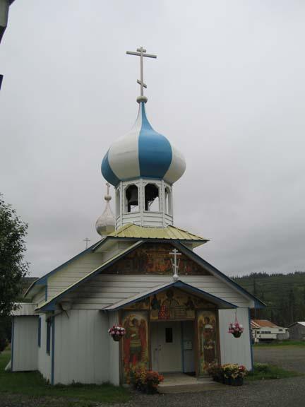
On the second day, 08/18/05, Thursday we drove a good distance to visit a Russian Old Believers Village named Nikolaevsk. Mary got some nice pictures of the Church of St Nicholas Russian Orthodox Church. It was locked and we could not get inside. We went there on the recommendation of a Russian man who worked at the Homer Visitors Center. He told us about a restaurant named Samovar. He said every time he ate there it was like going to his Grandmothers house.
 We went to Samovar for lunch. The lady who owned it was named Nina and she ran it and a gift shop by herself. She had a small kitchen that opened behind a horseshoe shaped bar with six stools. She prepared the food and set it on the bar. Mary was looking around while she worked and she asked if she could take pictures of the place. Nina said $5.00 per picture, to go to the children in Russia. Mary didn’t take any pictures. All during the food preparation and while we ate Nina tried to sell us items from the shelves of her gift shop. We told her we wanted a traditional Russian meal and let her choose for us what to eat. To start we had soup made from cabbage, potatoes, onion, and a broth from beet juice. With the soup we had fried, stuffed bread, one with potatoes and the other with sauerkraut. The main course was a combination of some kind of dumpling stuffed with beef and turkey, along with sliced polish sausage and kraut. It was good and filling. We about had to fight the old girl, but we passed on the desert. Another couple from our group came in while we were there and they had a desert and tea while we ate.
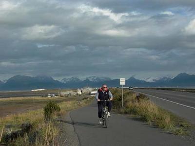
On Friday we had a fish fry with the big Halibut that Stan caught. Mary made cornbread for the meal. It was good food and e had a good time reliving some of the fish tales. Our Holiday Rambler staff did the cooking and the cleanup. After the meal Mary and I took a ride on our bicycles. There is a spit of land that runs out into the bay about five miles. In some places it is as wide as the road and in some places it is probably a quarter of a mile wide. It is called ‘The Spit”. There is a parking lot at the end of the mainland and a bike/walking path that runs out 3.2 miles to the Fishing Hole. We rode about half out there on Wednesday and we rode all 3.2 miles out to the Fishing Hole today.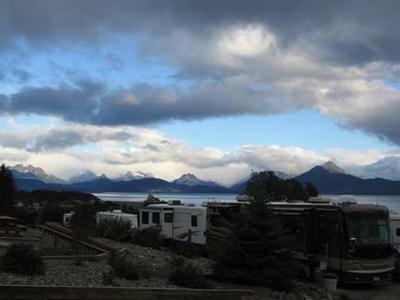 It is great exercise and you could never find a prettier place to ride.
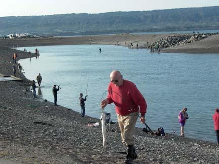
The Fishing Hole is a big man made pond with an opening out to the bay that allows the tide to come into the pond. The fish come in with the tide and when the tide goes out the fish are trapped in the big pond. There were a lot of people fishing there; old guys, young kids, and couples both old and young. Mary took pictures and the people were glad to pose for her. There was even a Black Lab there who jumped into the water and posed for her. It was fun to sit up on top on a bench and watch the fishermen and to watch the fish jumping out of the water. They were catching salmon that looked to be two feet long and must have weighed 10-12 pounds.
 Mary went out on Saturday by herself and I stayed home to catch up on my Journal. She went to al farmers market and shopped around. I think that all she bought was some catnip for our Grandcats. She visited a beautiful Church named the The All Saints of America Orthodox Mission. Some lay members were there and let her in she could take some pictures. I think that she is going to e-mail them back a copy of the pictures. She also got some good pictures at the Carl E Wynn Nature Center. Marv and Doris Cundiff told us that they went there and walked out on a trail and met a moose. Mary did not have that luck, but she got a lot of pictures.
This is a place where you could come and stay a month just on the Kenai Penisula.
Homer might be my favorite place that we have visited so far. We only had about an 80-mile drive to get from Kenai to Homer. Our travel buddies were Larry and Marty Haber. They are from Ft. Myers, FL. The drive down went well and we got to Homer by about 12:30. We didn’t leave until10:40 it was such a short trip. We have a beautiful RV Park and our site in the park is the prettiest because it is right beside the garden Mary got some great pictures. The park is right on the water and we have a pretty view.
 Homer is advertised as the Halibut fishing capitol of the world. If you are a fisherman this world be a paradise for you. On the second day our group of fishermen went out on a Halibut charter and caught a bunch of fish. The biggest one weighed 63 pounds, and they cut it up and we had a fish fry on the third day. The rest of the fish they had processed and frozen and the divided it equally and either had it shipped back to their homes or put it in freezers which they brought for that purpose.
On the second day, 08/18/05, Thursday we drove a good distance to visit a Russian Old Believers Village named Nikolaevsk. Mary got some nice pictures of the Church of St Nicholas Russian Orthodox Church. It was locked and we could not get inside. We went there on the recommendation of a Russian man who worked at the Homer Visitors Center. He told us about a restaurant named Samovar. He said every time he ate there it was like going to his Grandmothers house.
 We went to Samovar for lunch. The lady who owned it was named Nina and she ran it and a gift shop by herself. She had a small kitchen that opened behind a horseshoe shaped bar with six stools. She prepared the food and set it on the bar. Mary was looking around while she worked and she asked if she could take pictures of the place. Nina said $5.00 per picture, to go to the children in Russia. Mary didn’t take any pictures. All during the food preparation and while we ate Nina tried to sell us items from the shelves of her gift shop. We told her we wanted a traditional Russian meal and let her choose for us what to eat. To start we had soup made from cabbage, potatoes, onion, and a broth from beet juice. With the soup we had fried, stuffed bread, one with potatoes and the other with sauerkraut. The main course was a combination of some kind of dumpling stuffed with beef and turkey, along with sliced polish sausage and kraut. It was good and filling. We about had to fight the old girl, but we passed on the desert. Another couple from our group came in while we were there and they had a desert and tea while we ate.
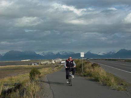
On Friday we had a fish fry with the big Halibut that Stan caught. Mary made cornbread for the meal. It was good food and e had a good time reliving some of the fish tales. Our Holiday Rambler staff did the cooking and the cleanup. After the meal Mary and I took a ride on our bicycles. There is a spit of land that runs out into the bay about five miles. In some places it is as wide as the road and in some places it is probably a quarter of a mile wide. It is called ‘The Spit”. There is a parking lot at the end of the mainland and a bike/walking path that runs out 3.2 miles to the Fishing Hole. We rode about half out there on Wednesday and we rode all 3.2 miles out to the Fishing Hole today.
 It is great exercise and you could never find a prettier place to ride.
The Fishing Hole is a big man made pond with an opening out to the bay that allows the tide to come into the pond. The fish come in with the tide and when the tide goes out the fish are trapped in the big pond. There were a lot of people fishing there; old guys, young kids, and couples both old and young. Mary took pictures and the people were glad to pose for her. There was even a Black Lab there who jumped into the water and posed for her. It was fun to sit up on top on a bench and watch the fishermen and to watch the fish jumping out of the water. They were catching salmon that looked to be two feet long and must have weighed 10-12 pounds.
 Mary went out on Saturday by herself and I stayed home to catch up on my Journal. She went to al farmers market and shopped around. I think that all she bought was some catnip for our Grandcats. She visited a beautiful Church named the The All Saints of America Orthodox Mission. Some lay members were there and let her in she could take some pictures. I think that she is going to e-mail them back a copy of the pictures. She also got some good pictures at the Carl E Wynn Nature Center. Marv and Doris Cundiff told us that they went there and walked out on a trail and met a moose. Mary did not have that luck, but she got a lot of pictures.
This is a place where you could come and stay a month just on the Kenai Penisula.
08/15/08 Monday and 08/16/08 Tuesday - Anchorage to Kenai
08/15/05 Monday and 08/16/05 Tuesday
 We were in the last group to leave the campground for our trip from Anchorage to Kenai. We traveled with Billie and Jaye Lundrigan. Billie is our Tail gunner, a factory trained mechanic who is always in the last group to go. He stays behind everyone so if there is mechanical trouble he can help out. That is a good feeling of security as we travel.
We followed a highway that ran along the Turnagain Arm of the Cook Inlet. This morning the tide is out so the Arm is just a mud flat. We were told that the tide here is thirty-three feet, so the water comes up a lot. When the tide is in this is a favorite feed spot for the Beluga Whales. Billie said he had seen hundreds of them at a time feeding in the shallow water of the Arm. Needless to say we didn’t see any whales today.
We did not have any excitement on the trip. We got to our campground early and got set up. We rode our bikes and explored a little. In the late afternoon we had a dinner, which was prepared for us by Kenaitze Indian Tribe and served, at their Elder Center; like Senior citizen centers at home. The food was good and we had a couple of women representatives of the tribe who spoke to us about the tribe and their home, customs and activities. The have a strong concern because their young people are losing the language and customs of the people. One of the ladies taught the language in the schools.
There is a great deal of Russian influence still evident in this section of Alaska. We saw some Russian Orthodox churches and an old cemetery. A lot of the nearby towns and villages have Russian names.
 On Tuesday the 16th, our group had a fishing trip. We did not go, but a large group went salmon fishing. I think they all caught their limit except one. Mary and I tried to start working on our blog. This is the first time we have really experimented with it. We will eventually get it going.
Mary bought her a really pretty jacket in the gift shop in the park.
 We were in the last group to leave the campground for our trip from Anchorage to Kenai. We traveled with Billie and Jaye Lundrigan. Billie is our Tail gunner, a factory trained mechanic who is always in the last group to go. He stays behind everyone so if there is mechanical trouble he can help out. That is a good feeling of security as we travel.
We followed a highway that ran along the Turnagain Arm of the Cook Inlet. This morning the tide is out so the Arm is just a mud flat. We were told that the tide here is thirty-three feet, so the water comes up a lot. When the tide is in this is a favorite feed spot for the Beluga Whales. Billie said he had seen hundreds of them at a time feeding in the shallow water of the Arm. Needless to say we didn’t see any whales today.
We did not have any excitement on the trip. We got to our campground
 early and got set up. We rode our bikes and explored a little. In the late afternoon we had a dinner, which was prepared for us by Kenaitze Indian Tribe and served, at their Elder Center; like Senior citizen centers at home. The food was good and we had a couple of women representatives of the tribe who spoke to us about the tribe and their home, customs and activities. The have a strong concern because their young people are losing the language and customs of the people. One of the ladies taught the language in the schools.
There is a great deal of Russian influence still evident in this section of Alaska. We saw some Russian Orthodox churches and an old cemetery. A lot of the nearby towns and villages have Russian names.
 On Tuesday the 16th, our group had a fishing trip. We did not go, but a large group went salmon fishing. I think they all caught their limit except one. Mary and I tried to start working on our blog. This is the first time we have really experimented with it. We will eventually get it going.
Mary bought her a really pretty jacket in the gift shop in the park.
08/11/05 Thursday through 08/14/05 Sunday - Denali to Anchorage
08/11/05 Thursday through 08/14/05 Sunday
We loved our time in Denali, but now we are on our way to Anchorage. We are traveling with Marv and Doris Cundiff. They are fun travel partners, they like to stop and enjoy what we are passing through. Marv has a GPS system and it is easy to stay on the route with it. We saw the most scenic highway that we have traveled so far today.
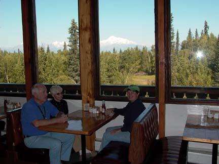
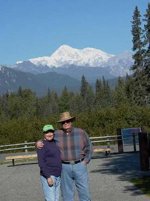 For the first 100 or so miles we traveled between the Alaska Mountain Range that has Mt. McKinley and the high peaks around it and on the other side of us and south toward Anchorage we had the Talkeetna Mountains. The view was outstanding for most of the 250-mile trip. Although we passed through some high passes and crossed the mountains several times, the road was good and we made good time and the driving was easy. We had a view of Mt. Mckinley for at least a hundred miles. I think that the closest we came to the big mountain was at lunchtime. We stopped at a place called Mary’s McKinley View Lodge. It was a Bed and Breakfast. In the restaurant the wall facing Denali was just big windows. You could sit and eat and enjoy. We got a great picture of it. It is one of the few pictures I took and it shows the view through the window with Mary, Doris and Marv sitting in a booth.
Another really outstanding stop we made was a rest area that was a memorial to the military veterans of Alaska. They had a big round area with marble monuments for each of the branches of the military. They included the Coast Guard along with the four major branches. The also had a few individual memorials and some notice to certain groups who had given outstanding service to Alaska specifically. It was as nice as any that I have seen in any state.
We arrived at the Golden Nugget Park and got set up by mid-afternoon. This is a nice park with all the amenities. One thing that I really like about it is that it is flat and has some good flat streets with low traffic volume so it is a great place to ride bicycles. It is the first time we could ride or bikes for a while. It is the first time we have been in a park where we can wash our vehicles in our parking slots. I washed the Motor Home good and the car. Mary cleaned up inside the house and went to the laundry in the park to catch up our washing. After I was through I went over to the laundry and ordered a pizza. We had supper and finished our work together.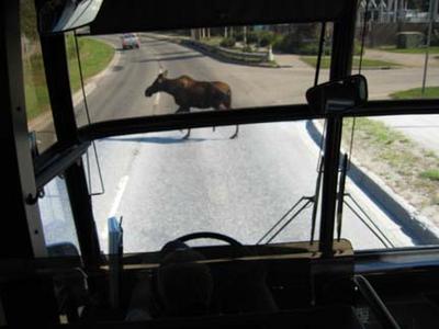
On Friday August 12th we had a city tour on a bus. We had a black tour guide who did a very good job. We haven’t seen a lot of black people in Canada or Alaska. We spent a couple of hours looking at the city, a couple of hours at The Alaska Museum and then we went to lunch at The Sourdough Mining Company. It was a big place with good food but they served it in a strange way. We got one thing at a time to eat; not like different courses, but like whatever they got cooked. First we just had coleslaw and bread, then we got some French fries, then some baked salmon, then some kind of meat. You never knew what you would get next and all of it had to be eaten separately or cold. I don’t recommend that style of service. We had a desert table where we could get our own cobbler and an ice cream machine. Mary provided the noontime entertainment when she turned on the machine to get the soft serve ice cream and she could not get it turned off. The bowl wasn’t big enough to hold it all, neither was her shoe!!!
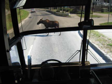
 Anchorage is a big city. The population is about 274,000, which is about 42% of the total population of Alaska. It is kind of nice to be back in civilization again for a while. Even here in the largest city there are signs warning you to watch out for moose. We saw two moose on our tour of the city. One out by the airport went into some trees before we could get a picture. The other one just ambled across the street and took his time getting off the street. Traffic just stopped until he was safely out of the way.
On Saturday the 13th we flew up to Nome. We spent the night there and flew back on Sunday afternoon. We flew on Alaska Air on a 727. The airport at Nome was a little bit scary because the runway was so short, but we landed safely. Our tour guide met us. His name was Hank; he came to Alaska in the Army back in the 1970’s and stayed. He married an Eskimo woman and has three tan kids. He is very active in the city government and politics. We got a history of Nome from the gold rush to current efforts to establish an economy based on a deep- water port and seafood industry. Their leading industry is Alaska King Crab and Halibut fishing. He is very upbeat and optimistic about the future of Nome.
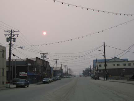
Nome is not a tourist town. It is old, ragged and looks like a third world country. We saw the entire town; we saw the beach and how they use suction dredges to mine goal off the floor of the Bering Sea. These dredges are small, one or two man operations and are all home made. We toured the company that processed the Alaska King Crab. Later in the afternoon went to an old mining operation and panned for gold. We got a little gold. After the panning we went to a sled dog demonstration by a guy who had run in the Iditarod.
There were eleven of us who went to Nome. Mary and I and one other couple spent the night and returned on Sunday. The other couple was the Greenwoods and they were from Talapossa, Georgia. That is about 65 miles from Atlanta just before you get to Alabama. We had a lot of fun; we stayed at the Nome Nugget Hotel. CW and Sandi have only been married since December. When we checked in they got a room with two single beds. They found out that we got a double bed and they went back and made them move their room. If they couldn’t have gotten a double bed I think that would have made Mary and I change rooms with them. We had dinner in a restaurant that was recommended to us. It wasn’t bad, but the service left a little to be desired. After dinner we just walked up and down Front Street.
  In a six-block section we passed 14 bars. They were all doing a good business. We met a lot of drunken Indian s and Eskimos. They all wanted to shake hands and visit with us. The next day we were talking to our tour guide about and he told us that there was a Native American Corporation which paid these people monthly for the mineral rights, especially oil. So they get a check from the government for that and most of them are also on welfare and have never worked a day in their lives, it is kind of a sad state of affairs.
We didn’t see exactly what we expected in Nome, but I am glad we went. I don’t think I would ever need to go again.
We loved our time in Denali, but now we are on our way to Anchorage. We are traveling with Marv and Doris Cundiff. They are fun travel partners, they like to stop and enjoy what we are passing through. Marv has a GPS system and it is easy to stay on the route with it. We saw the most scenic highway that we have traveled so far today.
 For the first 100 or so miles we traveled between the Alaska Mountain Range that has Mt. McKinley and the high peaks around it and on the other side of us and south toward Anchorage we had the Talkeetna Mountains. The view was outstanding for most of the 250-mile trip. Although we passed through some high passes and crossed the mountains several times, the road was good and we made good time and the driving was easy. We had a view of Mt. Mckinley for at least a hundred miles. I think that the closest we came to the big mountain was at lunchtime. We stopped at a place called Mary’s McKinley View Lodge. It was a Bed and Breakfast. In the restaurant the wall facing Denali was just big windows. You could sit and eat and enjoy. We got a great picture of it. It is one of the few pictures I took and it shows the view through the window with Mary, Doris and Marv sitting in a booth.
Another really outstanding stop we made was a rest area that was a memorial to the military veterans of Alaska. They had a big round area with marble monuments for each of the branches of the military. They included the Coast Guard along with the four major branches. The also had a few individual memorials and some notice to certain groups who had given outstanding service to Alaska specifically. It was as nice as any that I have seen in any state.
We arrived at the Golden Nugget Park and got set up by mid-afternoon. This is a nice park with all the amenities. One thing that I really like about it is that it is flat and has some good flat streets with low traffic volume so it is a great place to ride bicycles. It is the first time we could ride or bikes for a while. It is the first time we have been in a park where we can wash our vehicles in our parking slots. I washed the Motor Home good and the car. Mary cleaned up inside the house and went to the laundry in the park to catch up our washing. After I was through I went over to the laundry and ordered a pizza. We had supper and finished our work together.
On Friday August 12th we had a city tour on a bus. We had a black tour guide who did a very good job. We haven’t seen a lot of black people in Canada or Alaska. We spent a couple of hours looking at the city, a couple of hours at The Alaska Museum and then we went to lunch at The Sourdough Mining Company. It was a big place with good food but they served it in a strange way. We got one thing at a time to eat; not like different courses, but like whatever they got cooked. First we just had coleslaw and bread, then we got some French fries, then some baked salmon, then some kind of meat. You never knew what you would get next and all of it had to be eaten separately or cold. I don’t recommend that style of service. We had a desert table where we could get our own cobbler and an ice cream machine. Mary provided the noontime entertainment when she turned on the machine to get the soft serve ice cream and she could not get it turned off. The bowl wasn’t big enough to hold it all, neither was her shoe!!!
 Anchorage is a big city. The population is about 274,000, which is about 42% of the total population of Alaska. It is kind of nice to be back in civilization again for a while. Even here in the largest city there are signs warning you to watch out for moose. We saw two moose on our tour of the city. One out by the airport went into some trees before we could get a picture. The other one just ambled across the street and took his time getting off the street. Traffic just stopped until he was safely out of the way.
On Saturday the 13th we flew up to Nome. We spent the night there and flew back on Sunday afternoon. We flew on Alaska Air on a 727. The airport at Nome was a little bit scary because the runway was so short, but we landed safely.
 Our tour guide met us. His name was Hank; he came to Alaska in the Army back in the 1970’s and stayed. He married an Eskimo woman and has three tan kids. He is very active in the city government and politics. We got a history of Nome from the gold rush to current efforts to establish an economy based on a deep- water port and seafood industry. Their leading industry is Alaska King Crab and Halibut fishing. He is very upbeat and optimistic about the future of Nome.
Nome is not a tourist town. It is old, ragged and looks like a third world country. We saw the entire town; we saw the beach and how they use suction dredges to mine goal off the floor of the Bering Sea. These dredges are small, one or two man operations and are all home made. We toured the company that processed the Alaska King Crab. Later in the afternoon went to an old mining operation and panned for gold. We got a little gold. After the panning we went to a sled dog demonstration by a guy who had run in the Iditarod.
There were eleven of us who went to Nome. Mary and I and one other couple spent the night and returned on Sunday. The other couple was the Greenwoods and they were from Talapossa, Georgia. That is about 65 miles from Atlanta just before you get to Alabama. We had a lot of fun; we stayed at the Nome Nugget Hotel.
 CW and Sandi have only been married since December. When we checked in they got a room with two single beds. They found out that we got a double bed and they went back and made them move their room. If they couldn’t have gotten a double bed I think that would have made Mary and I change rooms with them. We had dinner in a restaurant that was recommended to us. It wasn’t bad, but the service left a little to be desired. After dinner we just walked up and down Front Street.
 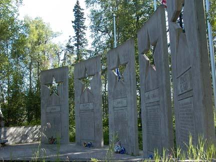 In a six-block section we passed 14 bars. They were all doing a good business. We met a lot of drunken Indian s and Eskimos. They all wanted to shake hands and visit with us. The next day we were talking to our tour guide about and he told us that there was a Native American Corporation which paid these people monthly for the mineral rights, especially oil. So they get a check from the government for that and most of them are also on welfare and have never worked a day in their lives, it is kind of a sad state of affairs.
We didn’t see exactly what we expected in Nome, but I am glad we went. I don’t think I would ever need to go again.
08/09/05 Tuesday through 08/10/05 Wednesday - Fairbands to Denali
08/09/05 Tuesday through 08/10/05 Wednesday
Today we go from Fairbanks to Denali. I have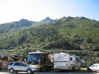 been looking forward to this since we started planning the trip. Denali National Park is supposed to be one of the most beautiful places on earth. We drew Tom and Joyce Knight as travel buddies today. They are retired to Melbourne, FL, but I think that they were originally from Pennsylvania. Tom has a brother named Ed who is also on the caravan.
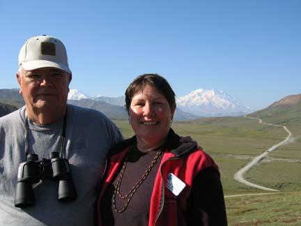
We had a very uneventful drive from Fairbanks to Denali. We did get our first view of Denali (Mt. McKinley) about 75 miles before we got to the Village of Denali. It is another 75 miles form the village to the mountain. We traveled the entire distance from Fairbanks to Denali along the East s ide of the Alaska Mountain Range. We saw some of the prettiest views along this road that we have seen. When we left Fairbanks it was cloudy and there was a lot of smoke in the air from fires. By mid-morning the sky had cleared and we had the prettiest day that we have had on the trip. McKinley was showing like a big white cone. Our Wagon Master has been here seven times before this trip and he told us he had only seen the mountain once. It is usually shrouded with fog and clouds.
When we got to our campground we were parked on a bluff overlooking the Nenana River. It is a great view from here. We were told by the people in the office that if we wanted to be assured of seeing Mt. McKinley and getting good pictures we had better go on out to the park and do it. We drove out to the park and went to the visitors’ center to get as much information as we could about the area. pullouts who told us that we had just missed a Grizzly bear. She said it had played around for an hour in her range of view and had just left. We did see a caribou down by the Savage River. While we watched he movWe found out that we were about 75 miles from the mountain and that the roads were only open to private vehicles about 15 miles. We drove as far as we could and took pictures. We were visiting with a lady sitting in one of theed up stream, came out of the river bottom and crossed the road. After he crossed the road, he turned and came back by us on the other side. We got some pretty good pictures.

We have a tour of the park scheduled for tomorrow. We located where we were to meet the bus and left the park. We stopped at a café on the way back home and had lunch. They advertised box lunches to be taken to the park, so we ordered one to be picked up the next morning and went back there and had breakfast and got our lunch.
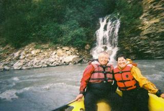
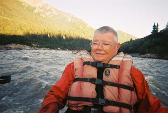
We had signed up for white water rafting trip along with eight other people in our group. We left the campground at 6:30 pm, and took a about a 12 mile float down the river from a place where they hauled us on a bus. We floated back to the campground where their company was located. The rapids in the river were class two and class three rapids that probably had waves that ranged from three feet to six feet. Some areas were pretty rough. I held on to those ropes pretty tight at times since I can’t swim. The life preserver that I wore had enough floatation to keep a large boat on top of the water. We had a great time. Mary had bought an underwater camera for snorkeling when we were on a cruise last year and it still had some film in it. She used it to take pictures instead of her digital camera. The pictures were not as good, but she didn’t damage her good camera.
We had quite a coincidence while we were on the river. There were a total of four rafts in our group. We met some people in the raft behind us who were from Lincoln, Alabama. The guy knew Bonnie Gosdeck's family. He was younger and did not know Bonnie, but he went to school and graduated with Kelly Alred who is Bonnie’s niece. We know her parents, Burt and Marie who is Bonnie’s sister. It’s a small world.

On Wednesday, 08/10/05 we left on our tour of Denali at 6:30 am. We did have breakfast and pick up our lunch. It was a really great tour. Our guide was very committed to the wilderness and it’s plant and animal life. She made sure that our group respected it. We spent about eight hours with her and learned a lot about the area. She was not a native, but I believe that she said she had been doing the tour for five years. She knows a lot of facts. Besides the natural beauty, which is outstanding, we saw a lot of wildlife. We saw Moose, Caribou, Reindeer, Dall Sheep, Black Bear, Grizzly Bear, a lot of small animals like Ground Squirrels, and a large variety of birds. We picked and ate wild berries, and rode over some scary roads. We went over about forty miles of dirt and gravel roads into the mountains where at some points we were on ridges that dropped off on both sides of the road. Once I asked how far down the drop was beside the road and she said about 800 feet.
 After we finished our tour we went to the ranger station and had a demonstration of how sled dogs were used by the rangers in the park. The ranger was very proud of their program. This is the only park in the National Park Service with the sled dog program. They do not use snow machines like snowmobiles. They use the dogs to haul equipment and supplies to the their outlying areas when the snow comes. I asked the ranger how often they worked the dogs. Early in the winter they might only work a few days a month. But by the end of winter they regularly took six-week trips and worked every day. Keep in mind that winter is usually eight or nine months long
Today we go from Fairbanks to Denali. I have
 been looking forward to this since we started planning the trip. Denali National Park is supposed to be one of the most beautiful places on earth. We drew Tom and Joyce Knight as travel buddies today. They are retired to Melbourne, FL, but I think that they were originally from Pennsylvania. Tom has a brother named Ed who is also on the caravan.
We had a very uneventful drive from Fairbanks to Denali. We did get our first view of Denali (Mt. McKinley) about 75 miles before we got to the Village of Denali. It is another 75 miles form the village to the mountain. We traveled the entire distance from Fairbanks to Denali along the East s
 ide of the Alaska Mountain Range. We saw some of the prettiest views along this road that we have seen. When we left Fairbanks it was cloudy and there was a lot of smoke in the air from fires. By mid-morning the sky had cleared and we had the prettiest day that we have had on the trip. McKinley was showing like a big white cone. Our Wagon Master has been here seven times before this trip and he told us he had only seen the mountain once. It is usually shrouded with fog and clouds.
When we got to our campground we were parked on a bluff overlooking the Nenana River. It is a great view from here. We were told by the people in the office that if we wanted to be assured of seeing Mt. McKinley and getting good pictures we had better go on out to the park and do it. We drove out to the park and
 went to the visitors’ center to get as much information as we could about the area. pullouts who told us that we had just missed a Grizzly bear. She said it had played around for an hour in her range of view and had just left. We did see a caribou down by the Savage River. While we watched he movWe found out that we were about 75 miles from the mountain and that the roads were only open to private vehicles about 15 miles. We drove as far as we could and took pictures. We were visiting with a lady sitting in one of theed up stream, came out of the river bottom and crossed the road. After he crossed the road, he turned and came back by us on the other side. We got some pretty good pictures.
We have a tour of the park scheduled for tomorrow. We located where we were to meet the bus and left the park. We stopped at a café on the way back home and had lunch. They advertised box lunches to be taken to the park, so we ordered one to be picked up the next morning and went back there and had breakfast and got our lunch.

We had signed up for white water rafting trip along with eight other people in our group. We left the campground at 6:30 pm, and took a about a 12 mile float down the river from a place where they hauled us on a bus. We floated back to the campground where their company was located. The rapids in the river were class two and class three rapids that probably had waves that ranged from three feet to six feet. Some areas were pretty rough.
 I held on to those ropes pretty tight at times since I can’t swim. The life preserver that I wore had enough floatation to keep a large boat on top of the water. We had a great time. Mary had bought an underwater camera for snorkeling when we were on a cruise last year and it still had some film in it. She used it to take pictures instead of her digital camera. The pictures were not as good, but she didn’t damage her good camera.
We had quite a coincidence while we were on the river. There were a total of four rafts in our group. We met some people in the raft behind us who were from Lincoln, Alabama. The guy knew Bonnie Gosdeck's family. He was younger and did not know Bonnie, but he went to school and graduated with Kelly Alred who is Bonnie’s niece. We know her parents, Burt and Marie who is Bonnie’s sister. It’s a small world.
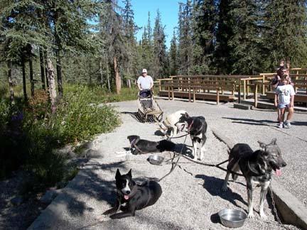
On Wednesday, 08/10/05 we left on our tour of Denali at 6:30 am. We did have breakfast and pick up our lunch. It was a really great tour. Our guide was very committed to the wilderness and it’s plant and animal life. She made sure that our group respected it. We spent about eight hours with her and learned a lot about the area. She was not a native, but I believe that she said she had been doing the tour for five years. She knows a lot of facts. Besides the natural beauty, which is outstanding, we saw a lot of wildlife. We saw Moose, Caribou, Reindeer, Dall Sheep, Black Bear, Grizzly Bear, a lot of small animals like Ground Squirrels, and a large variety of birds.
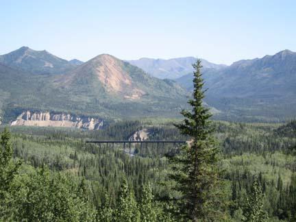 We picked and ate wild berries, and rode over some scary roads. We went over about forty miles of dirt and gravel roads into the mountains where at some points we were on ridges that dropped off on both sides of the road. Once I asked how far down the drop was beside the road and she said about 800 feet.
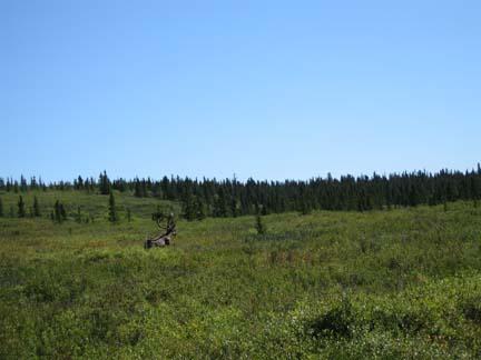 After we finished our tour we went to the ranger station and had a demonstration of how sled dogs were used by the rangers in the park. The ranger was very proud of their program. This is the only park in the National Park Service with the sled dog program. They do not use snow machines like snowmobiles. They use the dogs to haul equipment and supplies to the their outlying areas when the snow comes. I asked the ranger how often they worked the dogs. Early in the winter they might only work a few days a month. But by the end of winter they regularly took six-week trips and worked every day. Keep in mind that winter is usually eight or nine months long
08/03/08 Wednesday through 08/08/05 Monday - Tok to Fairbanks
08/03/05 Wednesday through 08/08/05 Monday
Today we went from Tok to Fairbanks. The trip was a very uneventful 199 miles. Our travel buddies were Bob and Marylou St. Germaine from Averill Park, NY. Bob is a retired metal worker. Be designed and built molds for sheet metal projects. He was telling Mary about some project he did for the first president Bush. I don’t remember just what it was, but Bob was real proud of it. It was something personal, maybe pertaining to a horse.
From Tok to Delta Junction we ran the last 105 miles of the Alaska Highway. We ran along the Eastern edge of the Alaska Mountain Range. There were some nice views there of some high peaks with a lot of snow on them.
We passed throu gh Dot Lake Village that is the Tanana Valley traditional Athabascan village. It was not a tourist site, but the homes of the local Indians. It would have been interesting to have stopped and visited with them, but there was no sign that the public was welcome to come in.
When we got to Delta Junction we stopped at the Visitors center. Delta Junction is a pretty good-sized town with a population of about 3500 people. It marks the end of the Alaska Highway. The historic 1422 mile pole is located in the visitor’s center. There is also some history of the Alaska Pipeline in the center. We visited there for a while then we went on to a place called Rika’s Roadhouse for lunch. This is the neatest place we have had for lunch since we have been traveling. It is the location of an old homestead. The house and all the outbuildings are all still there. Some had had some restoration, but they appear in their original condition, even the springhouse and the blacksmith shop. The gift shop was in the old house and some of the rooms still were furnished with the inventory sitting around on shelves and tables. The obvious addition was the restaurant. It also had a gift shop. Mary tried on a fur jacket of some kind. It looked real nice on her but I just took a picture and she hung it back up because it cost $3500.

The Tanana River is the major waterway in this area and it led us to Fairbanks. The Tanana River Bridge and Pipeline crossing is our first actual sighting of the Pipeline. This is on the Richardson Highway north of Delta Junction. We also crossed the Grestle River on the Black Veterans Memorial Bridge. This bridge was built in 1944 and was so named to commemorate the 3695 Black soldiers who worked on the Alaska Highway.
About twenty miles before we got to Fairbanks we passed Eielson Air force Base. A formation of planes, I think they were probably fighter planes of some sort, flew past us. Up ahead the first one on the left banked to his left, circled and flew back toward us. In about eight to ten second intervals the other three all banked and followed. Just after the last on passed us coming back toward us, the first one landed on a runway right along side of the highway. Mary got pictures of the other three as they the landed beside us. Later she was telling someone in our group about it and she was told that she was not supposed to be taking pictures. Of course, she had no idea that she should not take pictures. Later when we looked at the pictures from the day, she saw a sign in the first picture she took of the planes. It read in big letters NO STOPPING AND DO NOT TAKE PICTURES.
Just before we got to Fairbanks we passed through a little town named North Pole. Of course, there was a lot of Christmas and Santa Claus stuff there. We did not stop, but we will go b back out there. We are going to be in Fairbanks until next Tuesday. There is a lot of history to see here. Fairbanks started out as a trading post founded by ET Barnette on the banks of the Tanana River It was a struggle for a while and then an Italian immigrant named Fleix Pedro struck gold. With Barnette promoting the strike, they started a stampede of prospectors from the gold camps in the Klondike looking for better fortune. Fairbanks quickly grew into the largest city in Alaska and it still is.
 We checked in at Riverside RV Park just outside of town, after we were settled we got on a bus and went down to a place named Pioneer Park for a Salmon Bake. We had Salmon, fried Halibut and Cod, Prime Rib and all the trimmings. Later we went to a really fun and educational stage show about the founding and early days of Fairbanks.
We have a lot of interesting things to do here during the next four days. I just hope the weather cooperates. We have good phone service and we have Y_FI so we can get on the Internet when we need to. We are going to try to get our blog working.
On Thursday, 08/04/05, we had a full day of touring. We started off with a city tour. It was a waste because we had a driver who was on his first trip. He didn’t know what to tell us about what we were seeing. If our wagon master hadn’t been on this caravan about seven times we would have gotten no information about the city. He just took over the tour and let the other guy drive. He did know how to get us to where we were going.
 Our first stop was at the visitor’s center for the Alyeska Pipeline. That is the spelling that was on the sign. We learned a lot about the line and it’s construction. It is a bigger pipe than I visualized and it runs a lot of miles. When you consider the climate, especially temperature, it is amazing that they have been able to keep it flowing. They built it with expansion and constriction ability by putting slight S shaped curves in it to allow it to stretch and shrink. We also saw something which they call “PIGS”. The things run through the pipe, propelled by the flow of the oil. There are smart pigs and dumb pigs. The dumb pig just keeps the walls of the pipe cleared of paraffin that forms from the oil flow. The smart pig inspects the pipe as well as cleaning it. It records data about the condition of the oil flow and identifies areas where potential problems exist from corrosion and weakness in the material from which the pipe is made.
We went next to the Eldorado Gold Mine. Our tour here was probably as good as any I have ever been on. We got on a train as soon as we got there. We had a host who told us stories and played the fiddle. His granddaddy had been a fiddle player for some country music folks and had been on the Grand Ole Opry. He told us the history of the mine when we started up to the mine. They presented the history on sites along the track so we just stopped the little train and could look out, hear and even get pretty good pictures. We saw a sourdough camp, a tent where miners lived. Then we saw a miners cabin like they built after they had a claim and were working in one site. The person who was the miner even was working a cradle sluice and panning the creek. The next thing we saw was a donkey engine digging with an ore bucket and piling the dirt up go be washed in the spring when it thawed. They had a rule, dig in the winter and wash in the summer. When we got up to the location of the mine we were met by a couple that were actually still working a claim nearby. They worked for the company giving the tours as well. We saw how sluice boxes worked. The dumped a backhoe bucket of dirt into the sluice box and worked it down. They filled bags from what was left in the sluice box and gave each of us a bag and a pan.
 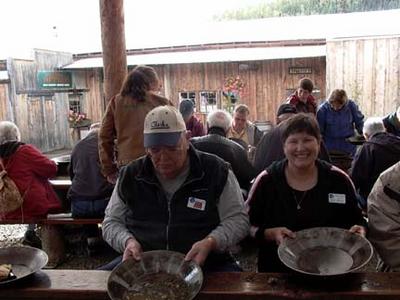 Mary and I worked the two bags of dirt that we got and we found 9.5 grains of gold, whatever that means. They told us at today’s market price it was worth $19.00. We bought Mary a locket with glass sides and put our gold in it, so she is carrying our entire gold mining fortune around her neck for the world to see.
We finished up by shopping in their gift shops. I think that they mine more gold from tourists than they ever did when the mine was operating. We went to lunch at a great place called the Pump House. It actually was a pumphouse during the mining days. The building housed 10 pumps that pumped water over the mountains to the mines in Crippled Creek Valley. The strike there produced more gold per mile of creek than any other in Alaska. The restaurant served good food and moved our large group through in good time.
We went to the University of Alaska Fairbanks and went to their Museum of Natural History. They had very interesting exhibits of the wildlife of the region as well as the local Indian and Eskimo culture. We spent a couple of hours there and then we went to the Georgeson Botanical Gardens. It was an experimental garden run by students at the university. They had the most beautiful flowers and some really nice vegetables. We saw a cabbage that was bigger than Mary’s head. We know because she lay on the ground and put here head beside it for a picture. They also had a farm where they raised Musk ox. We visited there and looked over the fence. Ugly animals.
In the evening we had a meeting with the travel agent who was setting up the optional tours. We did not get our first c hoice, which was to fly to Point Barrow. It was filled up and we only got to go to Nome. We are scheduled to do that next Saturday, the 13th. Several people are going up there, but only one other couple is spending the night.
On Friday and Saturday we spent our time cleaning the house inside and out and doing some need shopping. Mary found her a small digital camera that she has been looking for and she has spent a lot of time learning how to use it. It is really a nice camera. We found the store by talking to some young folks who are stationed here in the Army. They are not looking forward to winter because they are from Miami. We met them while we were eating breakfast at a Denny’s which advertised itself as the northern most Denny’s in the world.
On Sunday 08/07/05 we went to North Pole, AK. We had dinner at a restaurant named the Elf’s Den it was all decorated for Christmas, which was kind of weird for August, but the food was good. After dinner we went to a small community that was named Esther Gold Camp. We saw a show at the Crown of Light Theater. It was called a Northern Lights Photosymphony. All slides and music, it was a good show. Then we went to a stage show at the “World Famous Malemute Saloon”. It was funny and entertaining. These kinds of shows are popular in the tourist traps. I think this our third one.
On Monday, 08/08/05 we went for a tour of a couple of the rivers on the Riverboat Discovery. I enjoyed this a lot and learned a good deal about the area from the guy who did the commentary for the trip as well as some folks who talked to us along the way. We boarded the boat on the Chena River and traveled down stream to the Tanana River, which is the bigger stream that empties into the Yukon. The Chena is a clear water stream and the Tanana is glacier melt and is a very gray, almost white, color. The contrast where they merged is remarkable. Besides the information that we got over the speakers, the most notable things were a visit to a sled dog training camp and an Indian village.
The first stop that we made was at a sled dog training camp that was owned and operated by Susan Butcher, who won the Iditarod Race about four or five times in the 1990’s. She was not there, but a young lady named Jessie Royer works for her and owns some dogs of her own. Evidently Jessie is a protégé of Susan’s and has performed well in the Iditarod in the last couple of years. I think her best finish was 8th. She talked to us about the dogs training schedule and diet as they prepared for the race. “Mushing” is a big competitive sport as well as a recreational sport up here.
We also stopped at a mock up of an Athabascan Indian village and got of the boat for a tour. We had guides who took us through and talked to us about the society, culture, religion and day-to-day survival of a typical tribe. One of the most interesting things we saw was a fish wheel. It was turned b y the current of the river and scooped up salmon as they swam upstream to spawn. We also met an Athabascan lady named Dixie Alexander who did some of the most beautiful beadwork on leather that I have ever seen. There is a ceremonial dress which she made on display in the Museum of Natural History at the Smithsonian in Washington DC.
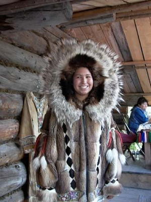
Small airplanes are a main mode of transportation up here. A large percentage of the fulltime residents are licensed pilots. As we traveled down the river most of the houses had a boat dock and along side it was a dock for an airplane with pontoons instead of wheels. We had a planned demonstration of taking off and landing on the river along side the boat.
Tonight we have our departure meeting for my favorite part of the trip.
Today we went from Tok to Fairbanks. The trip was a very uneventful 199 miles. Our travel buddies were Bob and Marylou St. Germaine from Averill Park, NY. Bob is a retired metal worker. Be designed and built molds for sheet metal projects. He was telling Mary about some project he did for the first president Bush. I don’t remember just what it was, but Bob was real proud of it. It was something personal, maybe pertaining to a horse.

From Tok to Delta Junction we ran the last 105 miles of the Alaska Highway. We ran along the Eastern edge of the Alaska Mountain Range. There were some nice views there of some high peaks with a lot of snow on them.
We passed throu
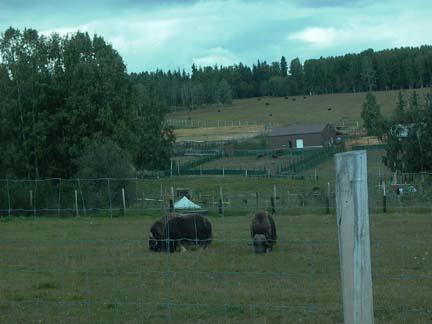 gh Dot Lake Village that is the Tanana Valley traditional Athabascan village. It was not a tourist site, but the homes of the local Indians. It would have been interesting to have stopped and visited with them, but there was no sign that the public was welcome to come in.
When we got to Delta Junction we stopped at the Visitors center. Delta Junction is a pretty good-sized town with a population of about 3500 people. It marks the end of the Alaska Highway. The historic 1422 mile pole is located in the visitor’s center. There is also some history of the Alaska Pipeline in the center. We visited there for a while then we went on to a place called Rika’s Roadhouse for lunch. This is the neatest place we have had for lunch since we have been traveling. It is the location of an old homestead. The house and all the outbuildings are all still there. Some had had some restoration, but they appear in their original condition, even the springhouse and the blacksmith shop. The gift shop was in the old house and some of the rooms still were furnished with the inventory sitting around on shelves and tables. The obvious addition was the restaurant. It also had a gift shop. Mary tried on a fur jacket of some kind. It looked real nice on her but I just took a picture and she hung it back up because it cost $3500.
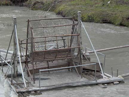
The Tanana River is the major waterway in this area and it led us to Fairbanks. The Tanana River Bridge and Pipeline crossing is our first actual sighting of the Pipeline. This is on the Richardson Highway north of Delta Junction. We also crossed the Grestle River on the Black Veterans Memorial Bridge. This bridge was built in 1944 and was so named to commemorate the 3695 Black soldiers who worked on the Alaska Highway.
About twenty miles before we got to Fairbanks we passed Eielson Air force Base. A formation of planes, I think they were probably fighter planes of some sort, flew past us.
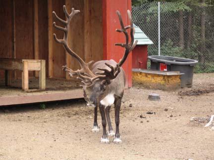 Up ahead the first one on the left banked to his left, circled and flew back toward us. In about eight to ten second intervals the other three all banked and followed. Just after the last on passed us coming back toward us, the first one landed on a runway right along side of the highway. Mary got pictures of the other three as they the landed beside us. Later she was telling someone in our group about it and she was told that she was not supposed to be taking pictures. Of course, she had no idea that she should not take pictures. Later when we looked at the pictures from the day, she saw a sign in the first picture she took of the planes. It read in big letters NO STOPPING AND DO NOT TAKE PICTURES.
Just before we got to Fairbanks we passed through a little town named North Pole. Of course, there was a lot of Christmas and Santa Claus stuff there. We did not stop, but we will go b back out there. We are going to be in Fairbanks until next Tuesday. There is a lot of history to see here. Fairbanks started out as a trading post founded by ET Barnette on the banks of the Tanana River It was a struggle for a while and then an Italian immigrant named Fleix Pedro struck gold. With Barnette promoting the strike, they started a stampede of prospectors from the gold camps in the Klondike looking for better fortune. Fairbanks quickly grew into the largest city in Alaska and it still is.
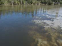 We checked in at Riverside RV Park just outside of town, after we were settled we got on a bus and went down to a place named Pioneer Park for a Salmon Bake. We had Salmon, fried Halibut and Cod, Prime Rib and all the trimmings. Later we went to a really fun and educational stage show about the founding and early days of Fairbanks.
We have a lot of interesting things to do here during the next four days. I just hope the weather cooperates. We have good phone service and we have Y_FI so we can get on the Internet when we need to. We are going to try to get our blog working.
On Thursday, 08/04/05, we had a full day of touring. We started off with a city tour. It was a waste because we had a driver who was on his first trip. He didn’t know what to tell us about what we were seeing. If our wagon master hadn’t been on this caravan about seven times we would have gotten no information about the city. He just took over the tour and let the other guy drive. He did know how to get us to where we were going.
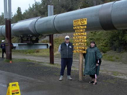 Our first stop was at the visitor’s center for the Alyeska Pipeline. That is the spelling that was on the sign. We learned a lot about the line and it’s construction. It is a bigger pipe than I visualized and it runs a lot of miles. When you consider the climate, especially temperature, it is amazing that they have been able to keep it flowing. They built it with expansion and constriction ability by putting slight S shaped curves in it to allow it to stretch and shrink. We also saw something which they call “PIGS”. The things run through the pipe, propelled by the flow of the oil. There are smart pigs and dumb pigs. The dumb pig just keeps the walls of the pipe cleared of paraffin that forms from the oil flow. The smart pig inspects the pipe as well as cleaning it. It records data about the condition of the oil flow and identifies areas where potential problems exist from corrosion and weakness in the material from which the pipe is made.
We went next to the Eldorado Gold Mine. Our tour here was probably as good as any I have ever been on. We got on a train as soon as we got there. We had a host who told us stories and played the fiddle. His granddaddy had been a fiddle player for some country music folks and had been on the Grand Ole Opry.
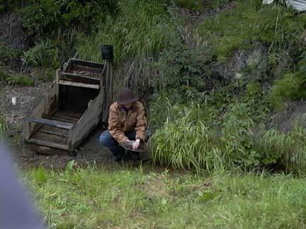 He told us the history of the mine when we started up to the mine. They presented the history on sites along the track so we just stopped the little train and could look out, hear and even get pretty good pictures. We saw a sourdough camp, a tent where miners lived. Then we saw a miners cabin like they built after they had a claim and were working in one site. The person who was the miner even was working a cradle sluice and panning the creek. The next thing we saw was a donkey engine digging with an ore bucket and piling the dirt up go be washed in the spring when it thawed. They had a rule, dig in the winter and wash in the summer. When we got up to the location of the mine we were met by a couple that were actually still working a claim nearby. They worked for the company giving the tours as well. We saw how sluice boxes worked. The dumped a backhoe bucket of dirt into the sluice box and worked it down. They filled bags from what was left in the sluice box and gave each of us a bag and a pan.
 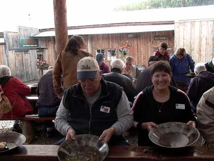 Mary and I worked the two bags of dirt that we got and we found 9.5 grains of gold, whatever that means. They told us at today’s market price it was worth $19.00. We bought Mary a locket with glass sides and put our gold in it, so she is carrying our entire gold mining fortune around her neck for the world to see.
We finished up by shopping in their gift shops. I think that they mine more gold from tourists than they ever did when the mine was operating. We went to lunch at a great place called the Pump House. It actually was a pumphouse during the mining days. The building housed 10 pumps that pumped water over the mountains to the mines in Crippled Creek Valley. The strike there produced more gold per mile of creek than any other in Alaska. The restaurant served good food and moved our large group through in good time.
We went to the University of Alaska Fairbanks and went to their Museum of Natural History. They had very interesting exhibits of the wildlife of the region as well as the local Indian and Eskimo culture. We spent a couple of hours there and then we went to the Georgeson Botanical Gardens.
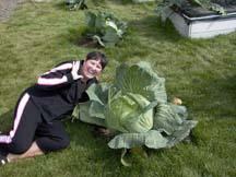 It was an experimental garden run by students at the university. They had the most beautiful flowers and some really nice vegetables. We saw a cabbage that was bigger than Mary’s head. We know because she lay on the ground and put here head beside it for a picture. They also had a farm where they raised Musk ox. We visited there and looked over the fence. Ugly animals.
In the evening we had a meeting with the travel agent who was setting up the optional tours. We did not get our first c
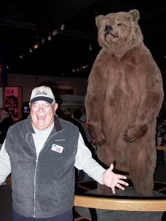 hoice, which was to fly to Point Barrow. It was filled up and we only got to go to Nome. We are scheduled to do that next Saturday, the 13th. Several people are going up there, but only one other couple is spending the night.
On Friday and Saturday we spent our time cleaning the house inside and out and doing some need shopping. Mary found her a small digital camera that she has been looking for and she has spent a lot of time learning how to use it. It is really a nice camera. We found the store by talking to some young folks who are stationed here in the Army. They are not looking forward to winter because they are from Miami. We met them while we were eating breakfast at a Denny’s which advertised itself as the northern most Denny’s in the world.
On Sunday 08/07/05 we went to North Pole, AK. We had dinner at a restaurant named the Elf’s Den it was all decorated for Christmas, which was kind of weird for August, but the food was good. After dinner we went to a small community that was named Esther Gold Camp. We saw a show at the Crown of Light Theater. It was called a Northern Lights Photosymphony. All slides and music, it was a good show. Then we went to a stage show at the “World Famous Malemute Saloon”. It was funny and entertaining. These kinds of shows are popular in the tourist traps. I think this our third one.
On Monday, 08/08/05 we went for a tour of a couple of the rivers on the Riverboat Discovery. I enjoyed this a lot and learned a good deal about the area from the guy who did the commentary for the trip as well as some folks who talked to us along the way. We boarded the boat on the Chena River and traveled down stream to the Tanana River, which is the bigger stream that empties into the Yukon. The Chena is a clear water stream and the Tanana is glacier melt and is a very gray, almost white, color. The contrast where they merged is remarkable. Besides the information that we got over the speakers, the most notable things were a visit to a sled dog training camp and an Indian village.
The first stop that we made was at a sled dog training camp that was owned and operated by Susan Butcher, who won the Iditarod Race about four or five times in the 1990’s.
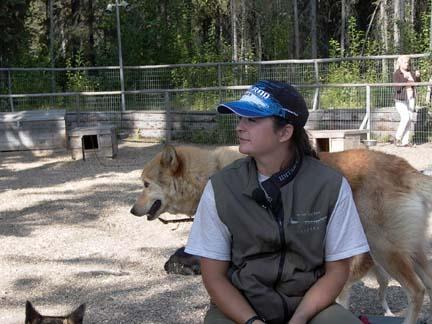 She was not there, but a young lady named Jessie Royer works for her and owns some dogs of her own. Evidently Jessie is a protégé of Susan’s and has performed well in the Iditarod in the last couple of years. I think her best finish was 8th. She talked to us about the dogs training schedule and diet as they prepared for the race. “Mushing” is a big competitive sport as well as a recreational sport up here.
We also stopped at a mock up of an Athabascan Indian village and got of the boat for a tour.
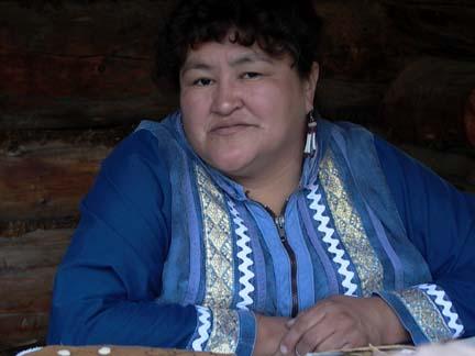 We had guides who took us through and talked to us about the society, culture, religion and day-to-day survival of a typical tribe. One of the most interesting things we saw was a fish wheel. It was turned b y the current of the river and scooped up salmon as they swam upstream to spawn. We also met an Athabascan lady named Dixie Alexander who did some of the most beautiful beadwork on leather that I have ever seen. There is a ceremonial dress which she made on display in the Museum of Natural History at the Smithsonian in Washington DC.
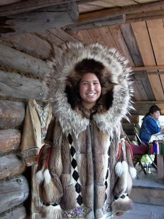
Small airplanes are a main mode of transportation up here. A large percentage of the fulltime residents are licensed pilots. As we traveled down the river most of the houses had a boat dock and along side it was a dock for an airplane with pontoons instead of wheels. We had a planned demonstration of taking off and landing on the river along side the boat.
Tonight we have our departure meeting for my favorite part of the trip.
08/02/05 Tuesday- Dawson City to Tok
08/02/05 Tuesday
Today we finish the Klondike Loop and drive over the toughest road that we will encounter of the trip. We are going from Dawson City, YT to Tok, AK. The trip is only about 185 miles, but it took us nearly nine hours, including all our stops. We traveled with Ed and Karlene Spivak from Placitas, NM. The Klondike Loop began where we left the Alaska Highway just north of Whitehorse. We drove 322 miles on Yukon Highway 2 to get to Dawson City. The part of the Loop that remains is Hwy 9 from Dawson City to Jack Wade Junction, which is called the Top of the World Highway, and then 85 miles on the Taylor Highway. Taylor gets us back to the Alaska Highway about 12 miles south of Tok, Alaska. Taylor Highway was pretty uneventful, but the Top of the World was something else. I am only estimating, but somewhere between 50 and 70 miles of this highway is either dirt or gravel. It had not rained in a while so there was a lot of dust. The road was very narrow and rough. In some places we drove on ridges where the land dropped away on both sides of the road into deep valleys. There were no guardrails. The views were truly awe-inspiring.
 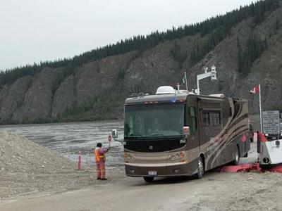 It was not so much the dramatic high peaks and snowcaps that you envision, but it was vast mountain ranges that went as far as you could see in any direction. The highest summit was 4515 feet. We crossed it about a mile south of the border crossing. We crossed into the United States at Poker Creek Border Crossing, which is the Northern most land border entry into the United States. The crossing, thus the Top of the World Highway is open from mid-May until the end of September. It is so isolated there that I’m sure that the people who work there must live there for the months which it is open. Several of our group really complained about this part of our trip. I would not have passed it up for anything, even though we did have four rock chips in our windshields to get repaired. We also spent three hours washing on our car and motor home. We got a lot of pictures, but they could never do justice to the view we had from this drive.
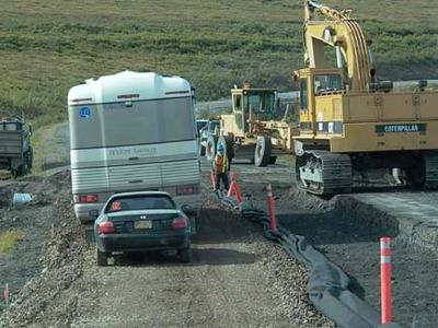
I’ inserting this as an afterthought. It really was one of the highlights of the day. We started our trip with a ferry crossing of the Yukon River. I guess the river was between a quarter and a half mile wide. The ferry would only hold two RV’s at most. It took us about three hours to make the crossing, so we were really spread out in this days travel. It was kink of tense driving that big vehicle onto and off of the boat.
Once we reached Jack Wade Junction, we had 96 miles to Tok. Eighty- five of those miles were on the Taylor Highway, which worked its way down out of the mountains into a huge valley where Tok is located. Took originated as a work camp for the construction of the Alaska Highway. I think that one of its major industries now is dogs. I guess they raise, train and race led dogs. It is a small town and the dog population is about double the Human population.

Our first town after we got into Alaska was Chicken. The miners who founded Chicken wanted to name it Ptarmigan, but they did not know how to spell that so they settled for Chicken, which in the North is a common name for Ptarmigan. Chicken’s most famous citizen was Ann Purdy, who wrote a book entitled TISHA. It was about her life in Chicken as a young schoolteacher. We did not buy the book but some of our group did. I guess it is quite entertaining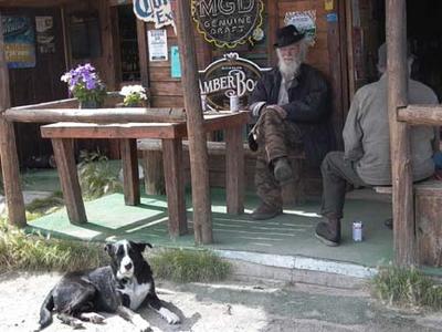 .
.
In the area of Chicken, there was gold discovered before the strikes in the Klondike. In 1895 the first strike in this area was make in Franklin Gulch on Fortymile River. The Lost Chicken Hill Mine on Chicken Creek is on of those early strikes. While traveling through this area and for many miles West of Chicken we drove through a burn area where 1.3 million acres burned in 2004. Our Wagon Master said they saw the fire when they passed through here last year. We saw some fires in the mountains along the border this morning.
After Chicken, the Taylor Highway is mostly straight, downhill and well paved. I really made up for our slow climbing drive of the morning. For a lot of the trip we probably got between 12 and 15 mpg on our fuel. We got to the Tok RV Village and found good wide pull-through sites with 30-amp electricity, good water and sewer. We had cable and Y_FI, which we did not use because it was $8.95 for the night. We will just wait until we get to Fairbanks.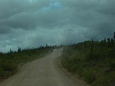
Today we finish the Klondike Loop and drive over the toughest road that we will encounter of the trip. We are going from Dawson City, YT to Tok, AK. The trip is
 only about 185 miles, but it took us nearly nine hours, including all our stops. We traveled with Ed and Karlene Spivak from Placitas, NM. The Klondike Loop began where we left the Alaska Highway just north of Whitehorse. We drove 322 miles on Yukon Highway 2 to get to Dawson City. The part of the Loop that remains is Hwy 9 from Dawson City to Jack Wade Junction, which is called the Top of the World Highway, and then 85 miles on the Taylor Highway. Taylor gets us back to the Alaska Highway about 12 miles south of Tok, Alaska. Taylor Highway was pretty uneventful, but the Top of the World was something else. I am only estimating, but somewhere between 50 and 70 miles of this highway is either dirt or gravel. It had not rained in a while so there was a lot of dust. The road was very narrow and rough. In some places we drove on ridges where the land dropped away on both sides of the road into deep valleys. There were no guardrails. The views were truly awe-inspiring.
 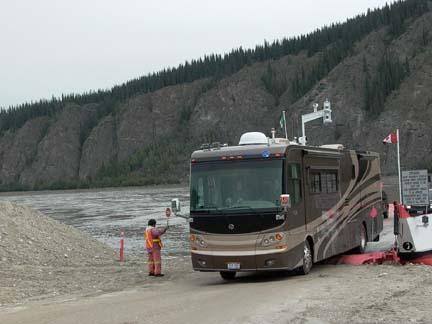 It was not so much the dramatic high peaks and snowcaps that you envision, but it was vast mountain ranges that went as far as you could see in any direction. The highest summit was 4515 feet. We crossed it about a mile south of the border crossing. We crossed into the United States at Poker Creek Border Crossing, which is the Northern most land border entry into the United States. The crossing, thus the Top of the World Highway is open from mid-May until the end of September. It is so isolated there that I’m sure that the people who work there must live there for the months which it is open. Several of our group really complained about this part of our trip. I would not have passed it up for anything, even though we did have four rock chips in our windshields to get repaired. We also spent three hours washing on our car and motor home. We got a lot of pictures, but they could never do justice to the view we had from this drive.
I’ inserting this as an afterthought. It really was one of the highlights of the day. We started our trip with a ferry crossing of the Yukon River. I guess the river was between a quarter and a half mile wide. The ferry would only hold two RV’s at most. It took us about three hours to make the crossing, so we were really spread out in this days travel. It was kink of tense driving that big vehicle onto and off of the boat.
Once we reached Jack Wade Junction, we had 96 miles to Tok. Eighty- five of those miles were on the Taylor Highway, which worked its way down out of the mountains into a huge valley where Tok is located. Took originated as a work camp for the construction of the Alaska Highway. I think that one of its major industries now is dogs. I guess they raise, train and race led dogs. It is a small town and the dog population is about double the Human population.
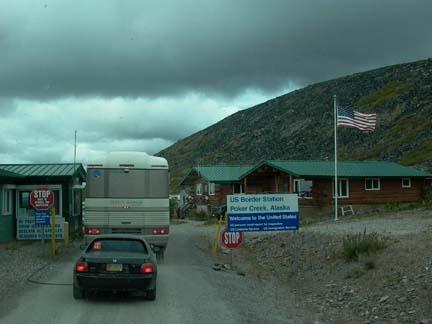
Our first town after we got into Alaska was Chicken. The miners who founded Chicken wanted to name it Ptarmigan, but they did not know how to spell that so they settled for Chicken, which in the North is a common name for Ptarmigan. Chicken’s most famous citizen was Ann Purdy, who wrote a book entitled TISHA. It was about her life in Chicken as a young schoolteacher. We did not buy the book but some of our group did. I guess it is quite entertaining
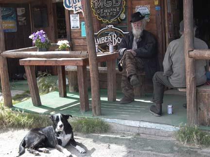 .
.In the area of Chicken, there was gold discovered before the strikes in the Klondike. In 1895 the first strike in this area was make in Franklin Gulch on Fortymile River. The Lost Chicken Hill Mine on Chicken Creek is on of those early strikes. While traveling through this area and for many miles West of Chicken we drove through a burn area where 1.3 million acres burned in 2004. Our Wagon Master said they saw the fire when they passed through here last year. We saw some fires in the mountains along the border this morning.
After Chicken, the Taylor Highway is mostly straight, downhill and well paved. I really made up for our slow climbing drive of the morning. For a lot of the trip we probably got between 12 and 15 mpg on our fuel. We got to the Tok RV Village and found good wide pull-through sites with 30-amp electricity, good water and sewer. We had cable and Y_FI, which we did not use because it was $8.95 for the night. We will just wait until we get to Fairbanks.
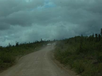
![]()